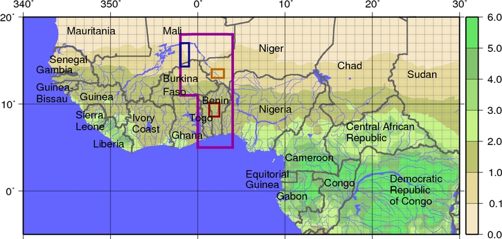
Benin meso-square
The Ouémé-Benin site (9oN10.2oN;
Guyot et al., 2009) has annual rainfall which averages between 12001300 mm.
The vegetation is wooded savannah with interspersed crops in-
cluding maize and niébé. Simulations will focus on the upper
Ouémé watershed (14,600 km2). There will also be a focus at a higher resolution over
the densely instrumented Donga catchment (which is a part of the the Oueme basin:
Seguis et al., 2011).
The rainy season lasts from
April to October. Contrary to the two other Sahelian sites, river
runoff is structured by an arborescent drainage network, and
sustained by the drainage of water-tables. The vegetation cover
is patchier than on the other sites, with forest clumps scattered
in mixed fields and fallow landscape.
Mali meso-square
The Gourma-Mali site located in the northern Sahel (14.8oN
17.3oN) is a typical rangeland region, covered with semi-arid
natural vegetation. LSM simulations will be focused on the
Hombori super site, a 50 x 50 km area which extends over
the central Sahel where most of the in situ instrumentation is
concentrated (Mougin et al., 2009). The rainy season is short,
lasting from late June to mid-September, with an average annu-
al precipitation recorded at Hombori over 19502007 of 370
mm. The site is characterized by three soil types over which two
different hydrologic systems operate. Vegetation comprises a
herbaceous layer almost exclusively composed of annual plants,
among which grasses dominate, and scattered bushes, shrubs,
and low trees.

Description of Experiments
Two main experiments will be performed, and they are differentiated by the spatial scale.
The first experiment will be at the mesoscale using a grid resolution of 0.05 degrees,
and covering
several years during and after the Enhanced Observation Period (EOP: 2005-2008) and en-
compassing the Special Observation Period (SOP: 2006). Participants will be requested to
run their models for the prescribed time period (which is a function of the site)
for the three mesoscale squares using two different atmospheric
forcing input datasets (which only differ in terms of the rainfall for the control experiments).
Hydrological models will perform this experiment for the Benin domain only (Ouémé and the
Donga sub-basin) where extensive hydrological measurements have been taken. The
second set of experiments will be performed at the local scale during the same time period
for several representative sites within each of the mesoscale "squares". The addition of more
optional experiments is possible if the time to do the runs and the required input data stay
reasonable.
Note that as of early 2013, the Donga experiment has been put on hold (it is optional).
We also request that modelers repeat the control experiments using the updated ECOCLIMAP2-v2 data,
which extends to 2008. Note, this is not applicable to models simulating the vegetation: for such models,
they will provide one set of control experiments from 2005-2008 (using both precipitation puts).
A summary of the Control and Optional mesoscale experiments is given below.
Note that we strongly recommend the optional experiments. More optional experiments might be discussed
during the ALMIP2 Workshop.
A summary of the local scale experiments is forthcoming.
* Please initialize the Mali Lagrangian ECOCLIMAP2-v2 experiment on Jan 1. 2008 using
the last time step from your Mali Thiessen ECOCLIMAP2-v2 run (Dec 31, 24h, 2007).
** Please initialize the Mali Lagrangian ECOCLIMAP2-v2 Alternate-soil-parameter experiment on Jan 1. 2008 using
the last time step from your Mali Thiessen ECOCLIMAP2-v2 Alternate-soil-parameter run (Dec 31, 24h, 2007).
Guyot, A., J.-M. Cohard, S. Anquetin, S., and C. R. Lloyd, 2009. Com-
bined analysis of energy and water balances to estimate latent heat flux of a
Sudanian small catchment. J. Hydro, 375, 227240.
Mougin, E., et al., 2009. The AMMA-CATCH Gourma observatory site in
Mali: Relating climatic variations to changes in vegetation, surface hydrology,
fluxes and natural resources. J. Hydro, 375, 1433.
Séguis M., Kamagaté B., Favreau G., Descloitres M., Seidel J.L., Galle S., Peugeot C., Gosset M., Le Barbé L., Malinur F.,
Van Exter S., Arjounin M., Wubda M., 2011. Origins of streamflow in a crystalline basement catchment in the sub-humid
Soudanian zone : the Donga basin (Benin, West Africa). Inter annual variability of water budget.
J. Hydro, 402, 1-13, doi: 10.1016/j.jhydrol.2011.01.054
Note that most of the
pertinent information on the experiment can be found in the
overview document.