Topography
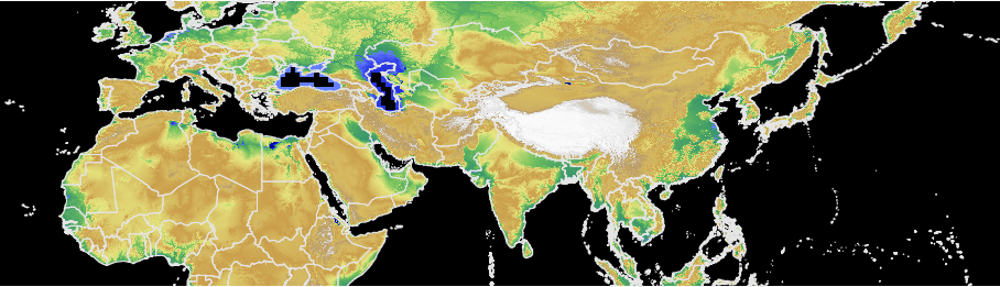
- GTOPO30, a global digital elevation model (DEM) with a horizontal grid spacing of 30 arc seconds (approximately 1 kilometer).
Source http://eros.usgs.gov/#/Find_Data/Products_and_Data_Available/gtopo30_info
Download
gtopo30.hdr.gz
and
gtopo30.dir.gz
- HYDRO1K: a global topographic index was deduced from global hydrologic database HYDRO1K, that itself is built fro GTOPO30.
Source http://eros.usgs.gov/#/Find_Data/Products_and_Data_Available/HYDRO1K
Download
topo_index.hdr.gz
and
topo_index.dir.gz
- srtm_ne_250m: a digital elevation model (DEM) with a horizontal grid spacing of approximately 250 meters (derived from srtm90 tiles, see https://bigdata.cgiar.org/srtm-90m-digital-elevation-database, only over the North East part of the world (latitude from 60N to 0N and longitude from 30W to 180E, see domain).
Download
srtm_ne_250m.hdr.gz
and
srtm_ne_250m.dir.gz
- srtm_se_250m: a digital elevation model (DEM) with a horizontal grid spacing of approximately 250 meters (derived from srtm90 tiles, see https://bigdata.cgiar.org/srtm-90m-digital-elevation-database, only over the South East part of the world (latitude from 0N to 60S and longitude from 30W to 180E, see domain).
Download
srtm_se_250m.hdr.gz
and
srtm_se_250m.dir.gz
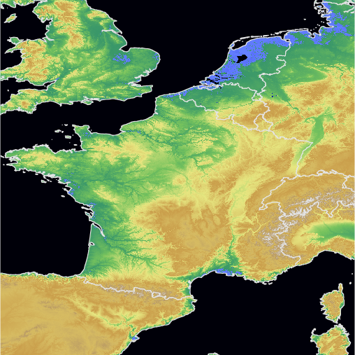
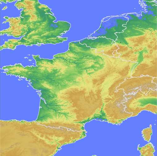
- srtm_france_90m: derived from srtm 90m tiles, see https://bigdata.cgiar.org/srtm-90m-digital-elevation-database, with a horizontal grid spacing of 3 arc seconds (approximately 90m), only over France (latitude from 55N to 40N and longitude from 5W to 10E, see domain). Warning: formerly called "srtm_europe".
Download
srtm_france_90m.hdr.gz
and
srtm_france_90m.dir.gz
- srtm_france_30m: made of srtm 30m tiles, see https://dwtkns.com/srtm30m, with a horizontal grid spacing of 1 arc seconds (approximately 30m), only over France (latitude from 55N to 40N and longitude from 5W to 10E, see domain ).
Download
srtm_france_30m.hdr.gz
and
srtm_france_30m.dir.gz
- GMTED2010: see http://topotools.cr.usgs.gov/gmted_viewer/.
Available here at 1km and 250m resolution.
Download- 1km resolution: GMTED2010_30.EHdr.dir.gz and GMTED2010_30.EHdr.hdr.gz.
- 250m resolution: GMTED2010_075.EHdr.dir.gz and GMTED2010_075.EHdr.hdr.gz.