

Home > Our research topics > Cyclogenesis study > PV inversion as a tool for synoptic forecasting
Rationale:
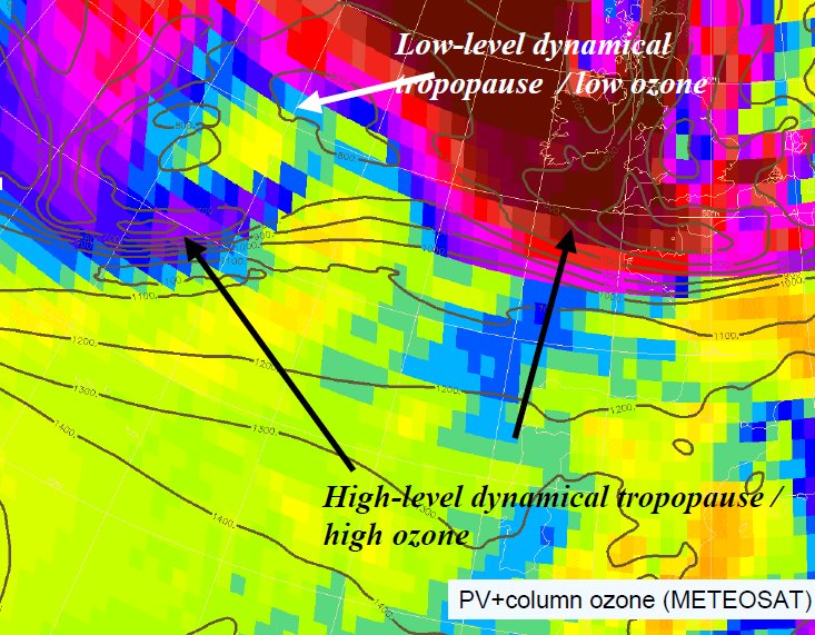
- upper-level PV patterns or coherent structures are key patterns for mid-latitudes weather system baroclinic development.
- Satellite images in IR or WV channels and total ozone retrievals may be used to assess initial conditions or very short range forecast of upper-level dynamics.
- PV modifications if there is any can be applied to model analyses if a PV inversion algorithm is available.
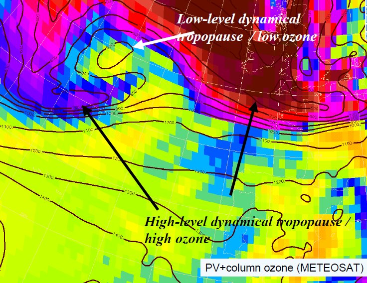
Senior Météo-France’s forecasters can modify the tropopause level when the consistence between satellite pictures and tropopuase dynamics is poor.
Upper-level dynamics assessment:
An example Klaus windstorm (23-24 january 2009). Below, a superimposition of the level of the surface with PV =1.5PVU with the Meteosat image can be found during the main growing phase of this extratropical cyclone.
| Operational analysis | modified analysis |
 |
 |
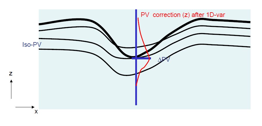 To incorporate these tropopause-level modifications it is necessary to build up 3D PV corrections.
To preserve the PV gradients at the tropopause levels 2, 2.5, 3, 3.5 PVU are also displaced according to the 1.5 PVU modification.
These modifications are considered as observations and incorporated together following a 1DVAR approach (see the figure on the left).
Then, the 3D PV correction are inverted in order to get wind and temperature corrections. The boundary condition, required in such a partial derivative equations problem, is an opportunity to incorporate surface modifications.
surface dynamics assessment:
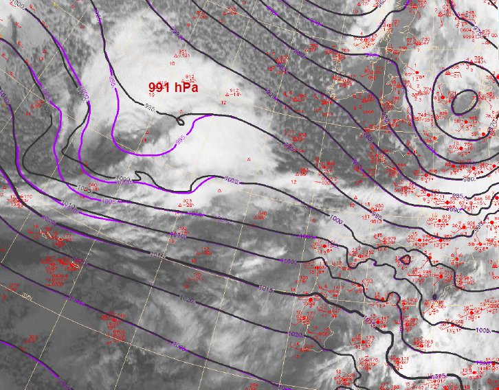
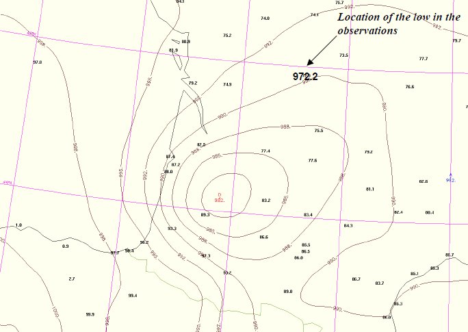
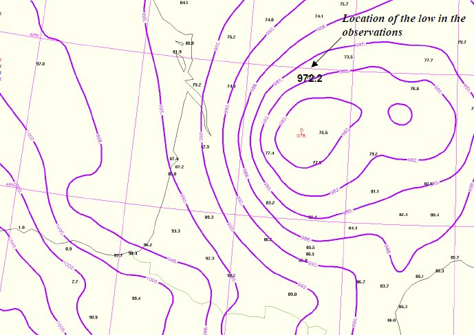
The figure above shows that the low is too weak in the initial conditions with respect to the rare observations present over the Atlantic. The corrected mean-sea level pressure, though it is not the truth, significantly improves the initial condition.
It is incorporated as a Dirichlet boundary condition at the model level closest to 850 hPa by specifying a geopotential correction. The depth of the correction in terms of wind and temperature is given by to constraint of no low-level PV modifications just above 850 hPa. This latter constraint determines the shape of the wind and temperature corrections such as in the figure below in the frame of a uniform PV balanced model:
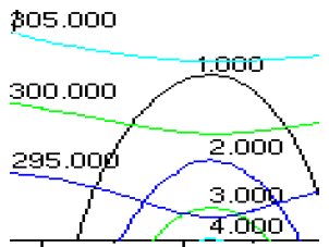
Vertical section of a low-level cyclone in a QG model with uniform PV . Potential temperature and vorticity are shown.
Result:
The operational global model ARPEGE is run with the modified initial condition. The MSLP forecast is significantly improved. The main MSLP gradient fits the areas of the strongest gusts.
| Operational forecast | modified forecast |
 |
 |
|