

Accueil > Our research topics > Cyclogenesis study > Evolution of a low-level cyclone in a storm in the absence of an upper-level precursor
Before reaching the french coasts, the two European storms of Christmas 1999 were two low-level cyclones with moderate amplitude traveling across the Alantic. They have rapidly deepened during their interaction with the upper-level large-scale jet. For the second storm, this interaction has been favored by the presence of an upper-level precursor which was not the case of the first storm. By removing the upper-level disturbance in a numerical simulation of the second storm, the latter disappears. This suggests that in the absence of upper-level precursor the dynamical properties of the low-level cyclone itself are crucial for its future evolution.
In order to identify these parameters, sensitivity numerical experiments have been performed using the french operational model ARPEGE. The idea consists of replacing the initial low of the first storm by an idealized one for which different characteristics can be modified such as its horizontal shape or position. Two factors favor the strong deepening of the idealized low as shown by the figure ; the case of a weak stretching and a position closer to the upper-level jet. It is curious to note that a slight change in its position such as a 1.5 degree shift may entirely change the scenario.
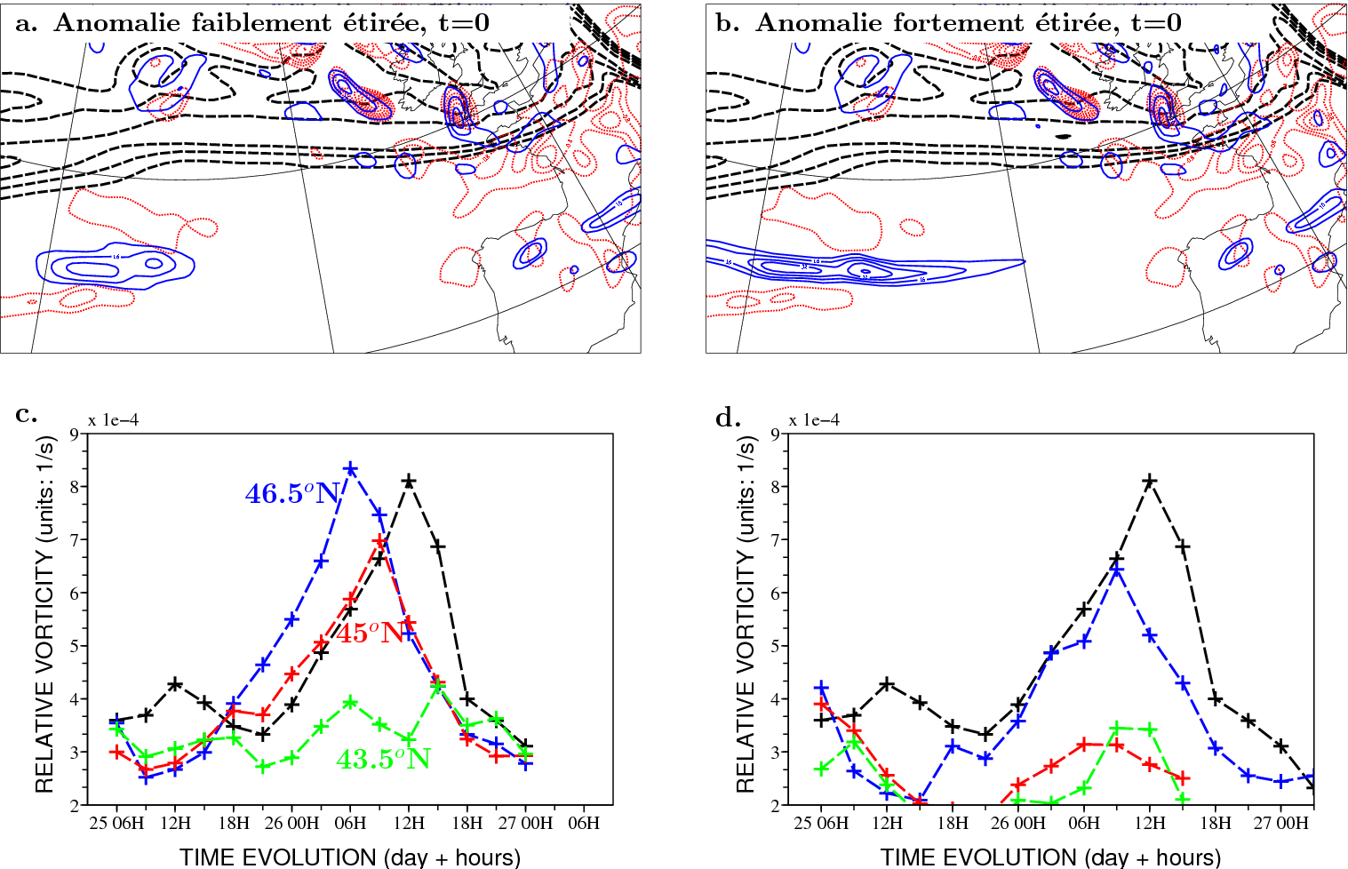
Upper panels present two different initial conditions where the initial low of the first storm has been replaced by an idealized one at 06 UTC 25 December 1999. The relative vorticity at 850 hPa (blue contours ; interval : 8 10-5 s-1), at 300 hPa (black contours, interval : 5 10-5 s-1) and the vertical velocity at 600 hPa (red contours, interval : 0.4 Pa.s-1) are represented for a a weakly stretched anomaly and b a strongly stretched anomaly centred at 36W, 45N. c evolution of the relative vorticity maximum at 850 hPa for an anomaly centred at 46.5N (blue), 45N (red), and 43.5N (green). d same as c but for a strongly stretched anomaly. The black curve corresponds to the forecast of the real storm starting at the same date.
|