

Accueil > Our research topics > Cyclogenesis study > Upper-Level Coherent Structures and Deep Convection
The relative importance of the two upper-level troughs, of the mid- to upper-level humidity and in the development of the heavy precipitating
event of September 2005 over southern France is investigated by considering their individual impacts using a hierarchy of numerical models from ARPEGE (global, hydrostatic, horizontal resolution of 25 km over France) to AROME (LAM, non-hydrostatic, 2.5 km resolution).
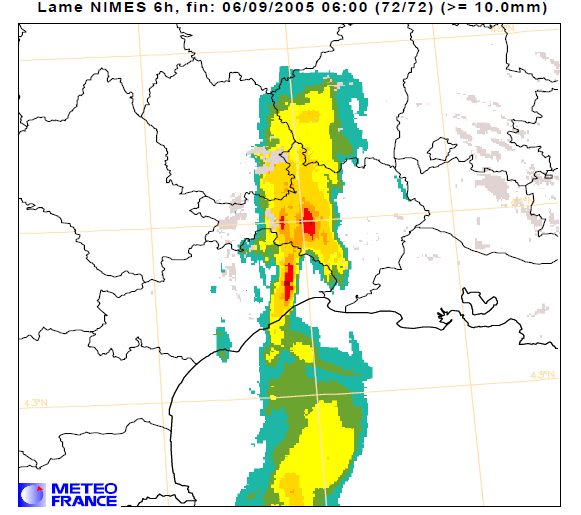
6-hour rain-gauge ending at 0600UTC 06/09/2005. Maximum precipitation are over the Gard department
To provide an extraction of various PV anomalies, the PV inversion technique developped by Arbogast et al. (2008) is used to produced the balanced
wind and mass fields associated with the troughs in order to remove them from the initial conditions. Removals of humidity which are more straightforward have also been applied to the ARPEGE initial conditions.
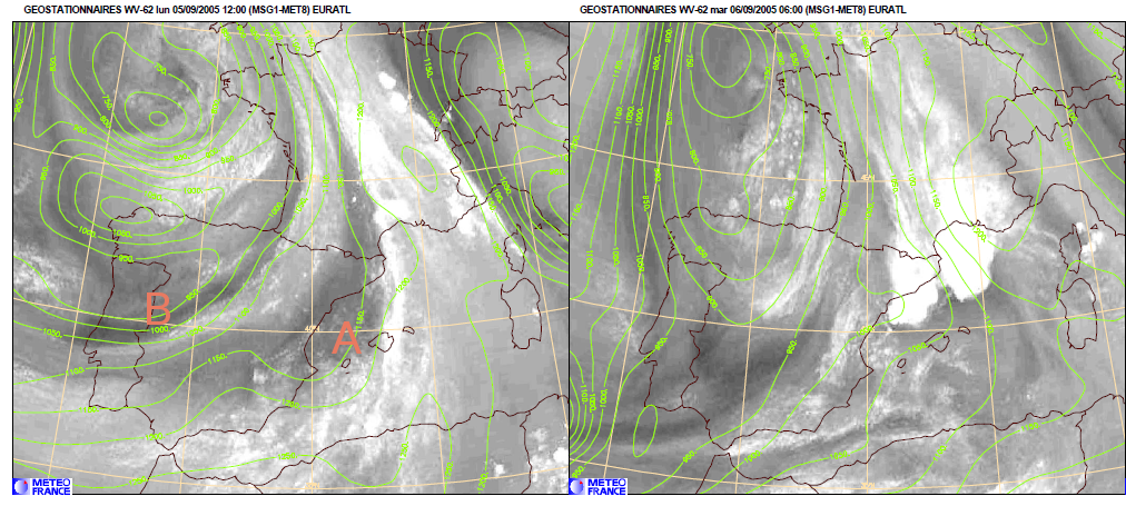
Meteosat WV 6.2 μm and ARPEGE 1.5PVU geopotential (green contours) at 1200 UTC 05/09/2005 (left panel) and 0600 UTC 06/092005 (right panel)
Left panel of the the figure just above presents several features of water vapour and PV in areas referred to as A and B.
It is shown that the precipitation forecast with the cloud-resolving model AROME is at least as sensitive to the preexisting moisture patterns than to the PV ones. It has also been shown that the mid- to upper-level humidity pattern A and in a less extent the southern trough B play an important role in the initial triggering and development of convection.
The two last figures suggest that the dry air pattern, initially located in area A may trigger convective activity in the vicinity of its leading edge.
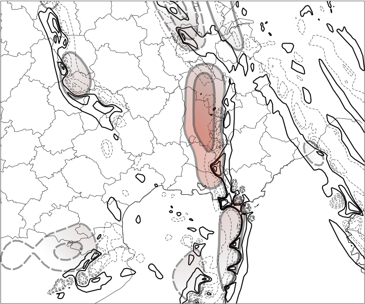
Sensitivity to the humidity pattern in area A ; difference of AROME runs with and without the moisture pattern in A valid at 0600 UTC 06/09/2005 ; Bold contours and light pink shading stand for the synoptic scale humidity field at 600 hPa recovered by spatial digital filtering ; thin dashed contours and light green shading stand for the small scale counterpart of the same field
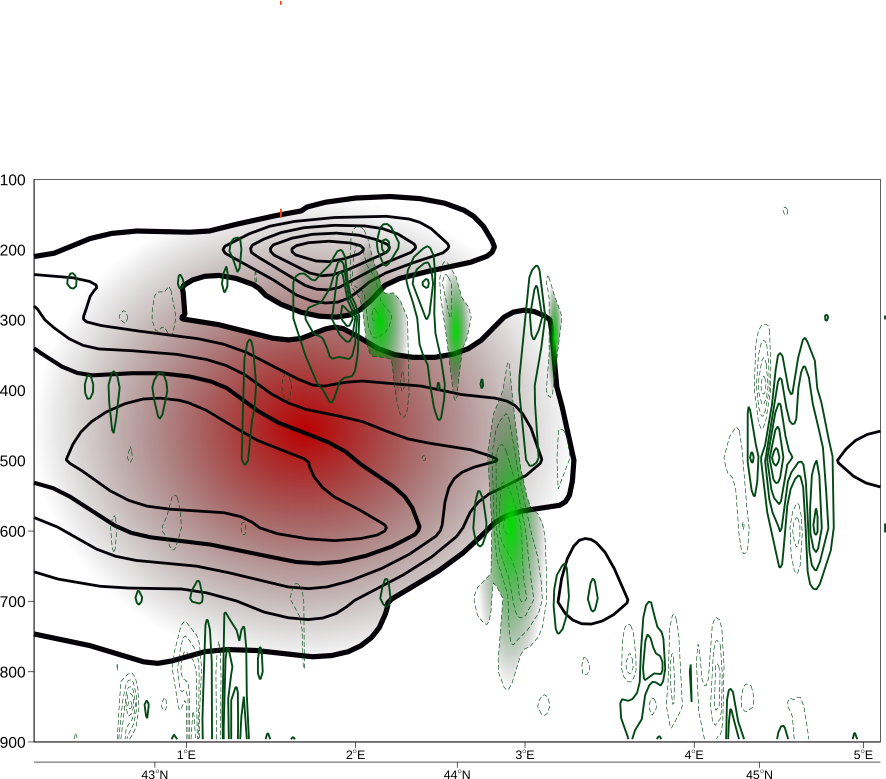
same as before but along a south-west to north-east vertical cross-section
This study supports the idea that the humidity field is crucial for the forecast of the convective systems having in mind that this parameter is recognized as the less well analyzed variable in the current operational assimilation systems.
A step forward would be to implement systematic initial conditions perturbations in terms of PV and humidity within ensemble prediction systems in particular when they are used as lateral boundary conditions for mesoscale ensembles.
|