(more details Josette.Vanderborght++at++oma.be)
The atmospheric situation of the 14 of August 1999 was characterised by an active low, coming from the North of France, passing over Belgium and going later over the Netherlands. In Belgium, a convective cluster with thunderstorms and also locally a tornado (between 1800Z and 1900Z), especially between TOURNAI and BRUSSELS (some tens of kilometer west of Brussels) were observed.

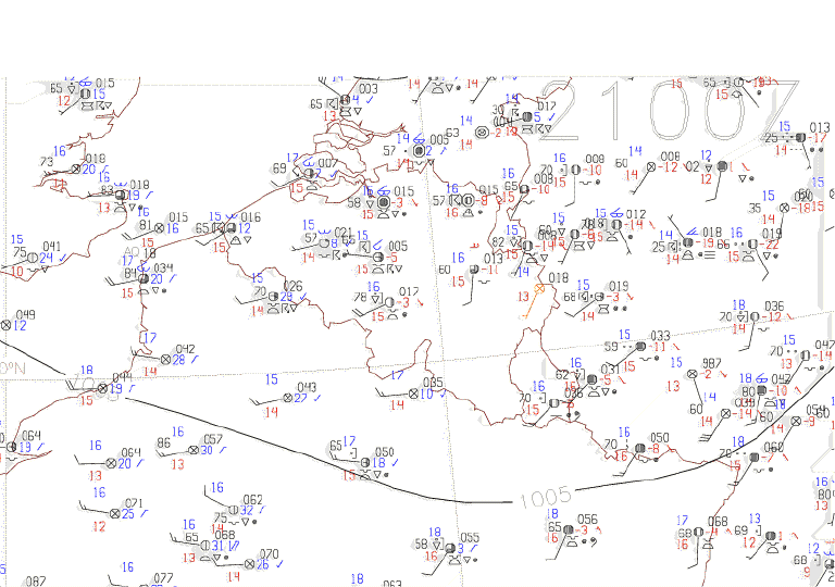
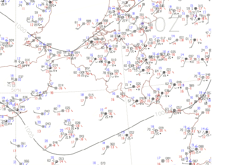
Three synoptic surface maps illustrate this atmospheric situation, observed respectively at 1800Z, 2100Z, and on August 15 at 0000Z, in a slightly bigger area then the ALADIN BELGIUM domain.
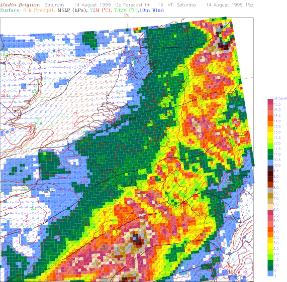
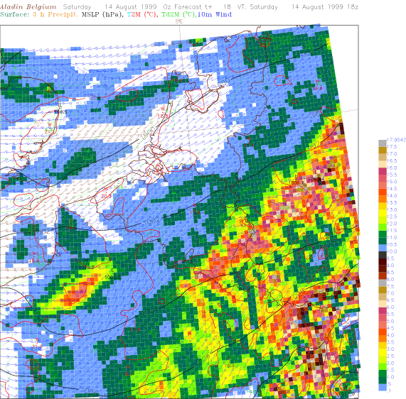
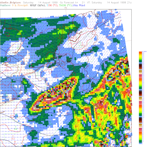
The 3 charts of the ALADIN BELGIUM model (for the run of 14/08/1999 at 0000Z) show, for the same dates, the forecasted 10m wind, the 2m temperature, the sea-level pressure and the cumulated precipitation during the previous 3 hours. They point out the presence of a severe perturbation, round 2100Z at small scale some tens kilometres south of Brussels. Only the geographical localisation is imprecise.
 |
Home |